
|
| Home | Mapping Services | Photogrammetry | About Us | Technical info | For Sale | Clients | Contact us |
Aerial Mapping Services
The raw digital map is processed and refined at two stations with KLT Atlas editing software. Final hard copies are produced on mylar or paper utilizing a Hewlett Packard Ink Jet Plotter. The final digital map file is translated to AutoCAD, MicroStation or other CAD, LIS/GIS system formats. |
| San-Lo Aerial Surveys, 1130 D Street, Suite 7, Ramona, CA 92065-0543 Tel: (858) 565-1024 Email: 460san-lo@san-lo.com 460san-lo@san-lo.com |
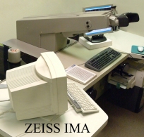 Digital map data is compiled from aerial photography at four computer
assisted stations, consisting of two Zeiss C-120/Atlas Plotters, an
IMA/Atlas fully analytical and aerotriangulation capable plotting system and
a KLT Atlas Digital Stereo Plotter with Digital Orthophoto capability.
Digital map data is compiled from aerial photography at four computer
assisted stations, consisting of two Zeiss C-120/Atlas Plotters, an
IMA/Atlas fully analytical and aerotriangulation capable plotting system and
a KLT Atlas Digital Stereo Plotter with Digital Orthophoto capability.